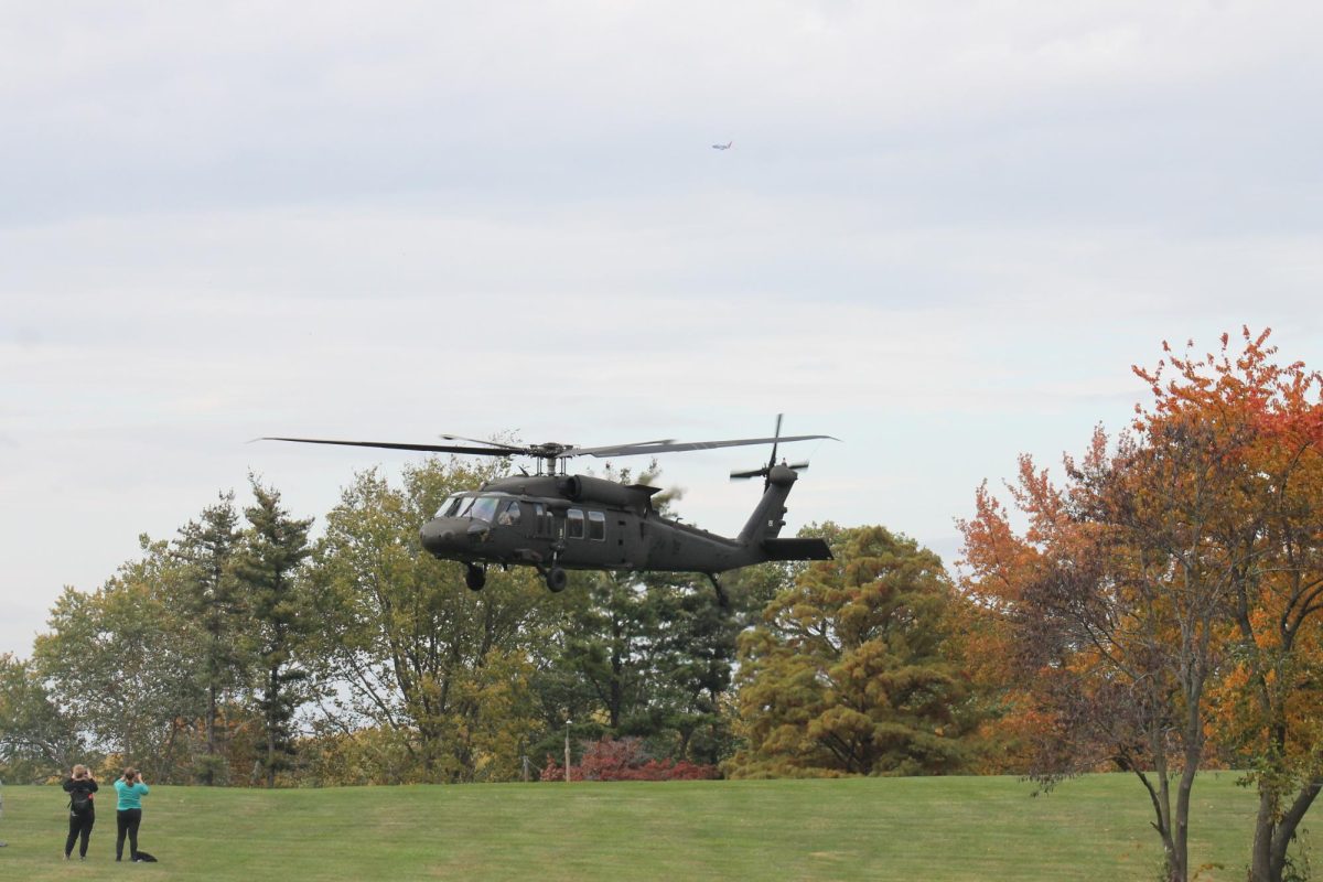
The Lindenwood Army ROTC, Missouri National Guard, and National Geospatial-Intelligence Agency hosted the Landing Navigation Event near the track on Wednesday, Oct. 25.
“We are Gateway Battalion Army ROTC,” cadet Lucas Gum said. “We are preparing the next generation of second lieutenants to lead the United States Army.”
The Land Navigation Event included three Black Hawk helicopters landing and taking off multiple times throughout the afternoon.
“Today, it was a joint exercise between the army and the National Geospatial-Intelligence Agency to get out and show them how we use the materials,” Gum said.
Gum and other ROTC members took part in the Land Navigation event as a way to show their ability to use materials provided by the National Geospatial-Intelligence Agency.
“It’s really important that as officers, we’re able to navigate using just a map and compass,” Gum said. “The [National Geospatial-Intelligence Agency] makes those materials, so they supply it to the Department of Defense, and as the army, we utilize it.”
For more information about the Land Navigation Event or ROTC, contact Lee Rodriguez at [email protected].


